At the time, I was freelancing for the local weekly paper, the Ute Pass Courier, and was able to take time off from my day job to cover the fire suppression activity. As we returned from church Sunday morning, the 8th, we saw the initial plume of smoke way out west and headed out there to get pictures.
In remembrance of the fire, I'd like to offer the following photo essay. All images are © Kenneth Wyatt. Permission for reuse may be obtained by emailing wyattphoto@mac.com.

Fire camps were set up near Lake George at the work camp on the south and also on the northern side of the fire. Much of the fire suppression was performed by ground crews, but the fire soon became out of control in the high winds and then helicopters were used to dump water and USAF C-130s were dispatched out of Pueblo Airport to dump slurry.

Public information officer briefing the news crews.

Large flame-up hitting the crown of the trees. This image was taken from near Lake George with a large 500mm lens.

C-130 slurry bomber north of Woodland Park.

The Horse Creek Cafe & Saloon, just off N. Highway 67, near Deckers.

Fire burning out of control north of Woodland Park.

Part of the helicopter operations near Lake George.

Ground crews north of Woodland Park controlling backfires set earlier to provide a buffer for the oncoming fire.

Backfire north of Woodland Park.

USFS map showing the boundary of the Hayman Fire.

Satellite imagery of the fire.

One of many thank you notes left following the fire.
I've been documenting the gradual recovery of the fire zone each year. Initially, the wildflowers and grasses popped up quickly. At five years, the aspens were about 6-8 feet high. I believe eventually, the dominant ponderosa, fir and spruce forest will primarily be replaced with aspens. It's been very slow-going, and will take a couple generations to re-establish a mature forest again.

Wildflowers blooming near blackened sentinels.

Rehab efforts were undertaken by multiple organizations. Here, Boy Scouts are shown planting thousands of seedlings in the burn area just north of Cheeseman Reservoir.

Erosion damage still occurring four years later.

A slurry of grass seed and water was dropped in many areas of the burn area.

Wildflowers growing in the burn area just north of Woodland Park.
Hope you enjoyed reviewing these images from the Hayman Fire and the years succeeding the fire. There are more fire images on my main web site here...

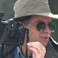
Photojournalist, Kenneth Wyatt, in Nomex protective gear.