Wednesday, July 02, 2025

Pictures of the Day 6/29/25 - Silverton Area


The mining (now tourist) town of Silverton (KW)

One of many abandoned gold and silver mines in the area (KW)

This was one of several waterfalls emptying into the Animas River (KW)

Wild iris found in a marshy spot along the road (KW)


Monday, June 30, 2025

Pictures of the Day (6/28/25) - Silverton Area

Silverton Area Wildflowers

 Columbine, Colorado's state flower
 
Columbine Closeup


Wild Iris

Picture of the Day - Durango, CO 6/28/25


The Durango and Silverton narrow gauge railroad the one of the major attractions in the area. This was just a chance encounter as we were about to pull into the RV camp. The railroad company has used several engines in the past and their current two were obtained from mining companies in Alaska. (KW)

Today was more of a "get settled" day and scouting trip later looking for the best spots to photograph the morning train to Silverton. Satellite imagery was used to help identify potential locations.

Saturday, June 28, 2025

Pictures of the Day 6/27/25 - Spanish Peaks

Spanish Peaks are located in the San Isabel National Forest between Trinidad and La Veta, Colorado. We were camped in the small town of Stonewall just to the right and behind the rightmost peak. The town of La Veta is shown in the foreground. (KW)

Silver Mountain, northwest of La Veta in the early morning light, with a bed of yellow surrounding it. (KW)

We're now headed to Durango for a few days and will be on the alert for wildflowers and other scenery in the area along US Highway 550.
 

Friday, June 27, 2025

Pictures of the Day 6/26/25 - Sills and Dikes

Colorado Highway 12 connects Trinidad, Colorado with La Vera and is registered as a Scenic Byway. The highway skirts the western Spanish Peak and the geology is noted for the numerous volcanic dikes. We camped in the town of Stonewall, which gets its name from the large sill on each side of Highway 12. What's the difference, since both sills and dikes look similar? A sill is several layers of sedimentary rock that has been uplifted to a vertical position. A dike is volcanic magma that has pushed up through cracks in the existing rock. You can see the layers of rock in the sill images above, while the dike, captured closer to the town of La Vita is solid. Notice the colorful rock layers with the soft afternoon lighting in the sills. The dike was photographed using the telephoto feature of an iPhone 15.

Sills and Dikes in the Spanish Peaks Region

A 'sill' near the town of Stonewall, off Highway 12 (drone photo). (KW)

A 'dike' along Highway 12. (KW)

Sill and cabin near Stonewall, Colorado. (KW)


Wednesday, June 25, 2025

Picture of the Day - 6/25/25 - Colorado Highway 12 Scenic Byway


Aspens - Colorado Highway 12 Scenic Byway. We had pulled off the road for a short break near the Spanish Peaks amid several aspen groves. It was difficult to chose just one for our 'picture of the day'.  I love combining aspen trunks with other elements. We'll be staying at the Stonewall Lodge and RV Park for the next two nights. Tomorrow, we'll show you why it got that name. (KW)


Tuesday, June 24, 2025

Picture of the Day - 6/24/25

Sheila and I have started our three-week tour around Colorado’s central Rockies to take in the wildflower blooms and mountain scenery. In a past life, I owned a photography business for 15 years that offered public seminars and Sheila and I also led several fall color and wildflower tours. This time, the tour was just for the two of us! (KW)

Today, we drove from our home in Northern Colorado to just outside of Colorado Springs at Cheyenne Mountain State Park. Little chance of pictures qualifying as a best “picture of the day”, but thought to set the scene, we’ll show our “house on wheels” for the next several days. Tomorrow, we head for a location called Stonegate, west of Trinidad. Notice those clouds! Rained most of the afternoon and evening.


Wednesday, September 27, 2023

Olympic Peninsula Fall Color - September 2023

A few rain forest and fall color scenes from my trip around the Olympic Peninsula yesterday.


Ruby Beach, Olympic Peninsula - September 2023

A few beach scenes from Ruby Beach, Olympic Peninsula, WA. Taken Sept 2023. 


Saturday, June 09, 2012

The Hayman Fire - 10 Years Later

The Hayman Fire was Colorado's largest fire in recorded history at over 138,000 acres burned, 133 homes burned to the ground and 6 fatalities. The US Weather Service had declared a "red flag" warning with under 10% humidity and high winds predicted. The county had declared a "burn ban", as well. It was started June 8th by USFS employee, Terry Barton, so she could allegedly appear a hero by saving the forest. She started the fire in a fire circle near Lake George and it jumped the ring in the high winds and quickly spread eastward. The fire was contained July 2 and finally brought under control July 18th.

At the time, I was freelancing for the local weekly paper, the Ute Pass Courier, and was able to take time off from my day job to cover the fire suppression activity. As we returned from church Sunday morning, the 8th, we saw the initial plume of smoke way out west and headed out there to get pictures.

In remembrance of the fire, I'd like to offer the following photo essay. All images are © Kenneth Wyatt. Permission for reuse may be obtained by emailing wyattphoto@mac.com.


Fire camps were set up near Lake George at the work camp on the south and also on the northern side of the fire. Much of the fire suppression was performed by ground crews, but the fire soon became out of control in the high winds and then helicopters were used to dump water and USAF C-130s were dispatched out of Pueblo Airport to dump slurry.


Public information officer briefing the news crews.


Large flame-up hitting the crown of the trees. This image was taken from near Lake George with a large 500mm lens.


C-130 slurry bomber north of Woodland Park.


The Horse Creek Cafe & Saloon, just off N. Highway 67, near Deckers.


Fire burning out of control north of Woodland Park.


Part of the helicopter operations near Lake George.


Ground crews north of Woodland Park controlling backfires set earlier to provide a buffer for the oncoming fire.


Backfire north of Woodland Park.


USFS map showing the boundary of the Hayman Fire.


Satellite imagery of the fire.


One of many thank you notes left following the fire.

I've been documenting the gradual recovery of the fire zone each year. Initially, the wildflowers and grasses popped up quickly. At five years, the aspens were about 6-8 feet high. I believe eventually, the dominant ponderosa, fir and spruce forest will primarily be replaced with aspens. It's been very slow-going, and will take a couple generations to re-establish a mature forest again.


Wildflowers blooming near blackened sentinels.


Rehab efforts were undertaken by multiple organizations. Here, Boy Scouts are shown planting thousands of seedlings in the burn area just north of Cheeseman Reservoir.


Erosion damage still occurring four years later.


A slurry of grass seed and water was dropped in many areas of the burn area.


Wildflowers growing in the burn area just north of Woodland Park.

Hope you enjoyed reviewing these images from the Hayman Fire and the years succeeding the fire. There are more fire images on my main web site here...


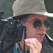
Photojournalist, Kenneth Wyatt, in Nomex protective gear.

Monday, February 13, 2012

Westside Community Center Mural


Fellow nature photographer, Ken Rush, teaches photography at the Westside Community Center. Rush proposed painting a large mural along one of their walls and started with a panoramic image of Garden of the Gods. Wondering how he planned to take the digital image file and turn it into a mural has now been answered! By projecting the image in sections using an LCD projector, he and his students were able to copy the major features and duplicate the color and tone onto the wall of the center, as shown above.

By clicking on the linked title above, you'll be able to see a time-lapse video of the painting!


Wednesday, January 18, 2012

Photographing Reflected Light

Photography is all about light and SEEING the light. The ability to notice unusual lighting and have the ability to capture it compositionally, separates the snapshooters from the true photographers. Rarely, is it possible to make a photograph in mid-day bright sun, as the light causes subject matter to end up too contrasty. Try squinting your eyes while looking at potential subjects under bright sun and you can simulate what your picture will look like - nothing but patchy darks and highlights. That's why most successful landscape photographers shoot in the early morning or late afternoon when the sun is low in the sky. Back in November, I explained why photographing forests in overcast weather is much preferred than with direct sun. This time, let's cover capturing reflected light. This is especially useful when photographing the desert landscape. This is also a great technique when photographing the sandstone formations in Garden of the Gods, and I'll show you some examples. Primarily, I'm looking for areas where the sun's light is reflected back on the rocks.


Here's a classic example where the North Gateway wall was reflecting onto the South Gateway wall near the petroglyph area. Because this was photographed in April, the trees were leafless and provided a nice graphic design. This occurred just after sunrise and is one of my favorite images of 2011.


One of my earliest instructors and colleagues, Weldon Lee, told us, "whenever you see water, think REFLECTION" and I've taken this to heart. I'm normally photographing early in the morning or late in the afternoon, when the sun is low in the sky. During our annual "Eagles & Ice" tour, we generally find ourselves along the South Platte River as it rushes along the canyon. Very often, sunlight will strike the sandstone cliffs and reflect into the water, as in the following images.


Because the image above was photographed in the shade, the snow casts a bluish tint, contrasting well with the golden reflection in the water. I tried to frame the water with the snowbanks.


Here's another example showing the contrast between the blue ice and golden reflection in the water as it races along in ever-downward cascades. I used a slow shutter speed (1/8-sec) to show motion in the water.


Taken in the shade, but reflecting the cool shadowed light from the canyon walls, this patch of ice crystals was taken with a 100mm macro lens from a distance of 12 inches. The crystals are very delicate and about an inch long.


Moving now to the area near Crystal, Colorado, we found ourselves deep within an aspen forest well after sunset. The faint glow in the sky was all it took to backlight this grove. Some of my very best landscapes have been taken well before sunrise or well after sunset. The digital imagers on today's DSLRs are very sensitive and tend to pick up colors better than the human eye can capture.


Here's another image taken at the Crystal Mill/Pumphouse. It was a late fall afternoon and after walking down the hillside to the Crystal River, I noticed that by getting down low to the ground, I was able to capture an astounding reflection of the fall colors in the river. I used a 1/4-second shutter speed to turn the water a bit "cottony", which smoothed the reflections. The camera was mounted just 18 inches from the ground with the closest boulders about a foot away. Amazingly, if one was to stand up along the river bank, the reflection would disappear.


Finally, moving now to the west coast of Oregon at Indian Beach, we arrived just in time for sunset. In surveying the area, I noticed a very shallow portion of the beach where a small creek was running into the ocean. I knew this would afford a large reflecting surface and I carefully aligned the framing so the rocky cliff and creek ended right at the corners. By the time the sky lit up, I was ready to capture the event.


I hope these examples have given you the desire to consider adding reflected light to your photographic repertoire. Always keep an eye out for these sometimes subtle  - and many times, intimate - landscapes!